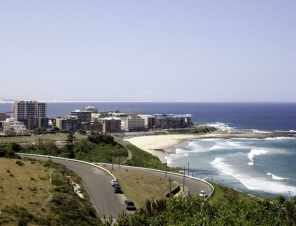
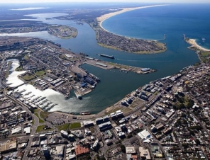
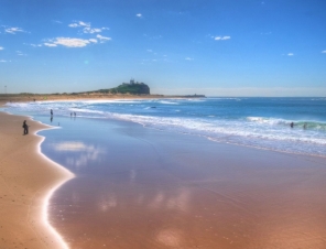
Newcastle is on the southern bank of the Hunter River mouth. The northern side is dominated by sand dunes, swamps and multiple river channels. A 'green belt' protecting plant and wildlife flanks the city from the west (Watagan mountains) around to the north where it meets the coast just north of Stockton. Urban development is mainly restricted to the hilly southern bank. The small town of Stockton sits opposite central Newcastle at the river mouth and is linked by ferry. Road access between Stockton and central Newcastle is via the Stockton Bridge, a distance of 20 km (12 mi). Much of the city is undercut by the coal measures of the Sydney sedimentary basin, and what were once numerous coal-mining villages located in the hills and valleys around the port have merged into a single urban area extending southwards to Lake Macquarie.
Newcastle has a borderline oceanic/humid subtropical climate like much of central and northern New South Wales. Summers tend to be warm and winters are generally mild. Precipitation is heaviest in late autumn and early winter.
The Port of Newcastle remains the economic and trade centre for the resource rich Hunter Valley and for much of the north and northwest of New South Wales. Newcastle is the world's largest coal export port and Australia's oldest and second largest tonnage throughput port, with over 3,000 shipping movements per annum.
Before European settlement Newcastle and the lower Hunter Region were traditionally occupied by the Awabakal and Worimi Aboriginal People, who called the area Malubimba.
In September 1797 Lieutenant John Shortland became the first European to explore the area. His discovery of the area was largely accidental; as he had been sent in search of a number of convicts who had seized HMS Cumberland as she was sailing from Sydney Cove. While returning, Lt. Shortland entered what he later described as "a very fine river", which he named after New South Wales' Governor, John Hunter. He returned with reports of the deep-water port and the area's abundant coal. Over the next two years, coal mined from the area was the New South Wales colony's first export.
Newcastle gained a reputation as a "hellhole" as it was a place where the most dangerous convicts were sent to dig in the coal mines as harsh punishment for their crimes. By the start of the 19th century the mouth of the Hunter River was being visited by diverse groups of men, including coal diggers, timber-cutters, and more escaped convicts.
In 1801, a convict camp called King's Town (named after Governor King) was established to mine coal and cut timber. In the same year, the first shipment of coal was dispatched to Sydney. This settlement closed less than a year later.
A settlement was again attempted in 1804, as a place of secondary punishment for unruly convicts. The settlement was named Coal River, also Kingstown and then renamed Newcastle, after England's famous coal port.
The new settlement, comprising convicts and a military guard, arrived at the Hunter River on 27 March 1804 in three ships: HMS Lady Nelson, the Resource and the James. The convicts were rebels from the 1804 Castle Hill convict rebellion.
The link with Newcastle-upon-Tyne, England, its namesake and also whence many of the 19th century coal miners came, is still obvious in some of the place-names – such as Jesmond, Hexham, Wickham, Wallsend and Gateshead. Morpeth.
Christ Church Cathedral dominates the skyline of Newcastle.
Under Captain James Wallis, commandant from 1815 to 1818, the convicts' conditions improved, and a building boom began. Captain Wallis laid out the streets of the town, built the first church of the site of the present Christ Church Anglican Cathedral, erected the old gaol on the seashore, and began work on the breakwater which now joins Nobbys Head to the mainland. The quality of these first buildings was poor, and only (a much reinforced) breakwater survives. During this period, in 1816, the oldest public school in Australia was built in East Newcastle.
Newcastle remained a penal settlement until 1822, when the settlement was opened up to farming. Military rule in Newcastle ended in 1823. Prisoner numbers were reduced to 100 (most of these were employed on the building of the breakwater), and the remaining 900 were sent to Port Macquarie.
During the Second World War, Newcastle was an important industrial centre for the Australian war effort. Consequently, it was considered to be a potential Japanese target during the Second World War. In the early hours of 8 June 1942, the Japanese submarine I-21 briefly shelled Newcastle. Among the areas hit within the city were dockyards, the steel works, Parnell Place in the city's now affluent East End, the breakwall and Art Deco ocean baths. There were no casualties in the attack and damage was minimal.
Where do the ships berth in Newcastle?
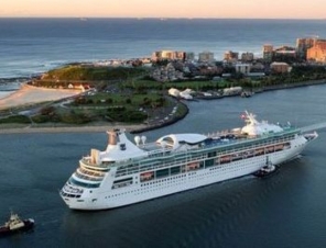
Cruise ships visiting the Port of Newcastle generally berth at the Channel Berth, or alternatively the Dyke 1 Berth. These berths are located at Dyke Point, Carrington and only a short distance to the city centre. Access into the port is permitted on days of cruise ship visits for any cruise-related traffic via the port entry at Bourke Street, Carrington.
How far is it to the city centre?
It is about 4 kilometers to the city centre, which is on the other side of the Hunter River from the port berth.
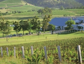
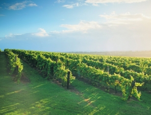
How far is it to the Hunter Valley vinyards.
One of the main wineries in the Hunter Valley is The Olive Tree, which is 60 kilometers from the port.

 |
|


